Discover your inside story with AncestryDNA®
Showing posts with label Maps. Show all posts

November 25, 2020

1910 Hertfordshire Inland Revenue Maps Available

There is a helpful guide to finding records of the UK Valuation Office Survey which was carried out between 1910 and 1915. The survey provided a unique snapshot of land and property in the Edwardian era, assessing its worth, how it was used and by whom 

The survey took place as a result of the 1909-1910 Finance Act which provided for the levy and collection of a duty on land in the United Kingdom based on any increased value of the land as a result of public money spent on communal infrastructure – a so-called ‘increment value duty’.

The Valuation Office was set up by the Inland Revenue in 1910 for England and Wales (and in 1911 for Scotland) to carry out the work of the survey.

118 valuation districts were established in England and Wales, each in the charge of a district valuer and each comprised a number of income tax divisions. It was by these valuation districts and income tax divisions that the work of the survey was organised and carried out.

Some 1910 Inland Revenue map and forms are being indexed and can be searched through Hertfordshire Names Online.

March 16, 2016

Talbot Settlement Maps of Elgin County Now Online

Col. Thomas Talbot was a controversial figure in early Ontario settlement. In the early 1800s in what was then called Upper Canada, Talbot was allowed to dole out land in Elgin County. Every time he gave, at his whim, 50 acres to a settler, he received land for himself. 

He made decisions arbitrarily based on who he liked, and single-handedly managed to create a lot of discontent among early settlers. He was often accused of erasing a settler's name from a previous land allotment and assigning the land to someone else, if the original settler displeased him. In fact my own ancestor's brother suffered such a fate under Talbot's despotic rules. 

In 1819 Jacob Peer submitted a petition stating that Talbot had granted him land, and promised that he, Jacob, could extend to the land bordering his in order to build a mill. Then Talbot denied that promise, forcing Jacob to purchase the land. To make things worse, Talbot then assigned the land that Jacob owned to another settler. 

Here is an interesting excerpt from some of the letters exchanged during Peer's petition.

Letter dated 20 Dec. 1819 from York from T. Rideout to the Surveyor General's Office stating that "how far Colonel Talbot was authorized to remove a settler when once located I am unable to say." Another letter from William Powell to Sir Peregrine Maitland points out that if the petitioner Jacob Peer wins his suit, it could have other consequences and that it is doubtful that Talbot would consider himself accountable to the Board. He therefore recommends that the petition from Jacob be directed to Talbot personally and that Talbot report on it. Talbot writes a  letter dated 30 April 1819 to Wm. Myers stating that "in consequence of your not having moved on the Lot 75 west on the North Branch of Talbot Rd. in Westminster, I have located the said lot to Mary Schram" and that the lot is estimated to be worth 50 dollars which will be paid to him. FN2
 

Jacob filed many petitions and affidavits from other settlers who swore they had been present when Talbot promised the land freely to Jacob but it was all in vain. Jacob lost his case and was ruined financially, having built a grist mill and saw mill at his own expense on the land he purchased, and which was taken from him and given to another settler. All because he displeased Talbot. 

However Talbot's maps are an invaluable source for genealogists!  Thanks to the Elgin County Archives and the Archives of Ontario, Talbot's maps are now onlline. The Archives of Ontario lent the maps to Elgin County Archives so that they could be digitized and made available to the public.
 
Talbot  made note of villages, First Nations settlements and footpaths, industrial sites such as mills, and early transportation routes throughout the region. The documents also include the names and locations of landowners. FN1. This gives us names and locations of early settlers and will be extremely useful to genealogists. 


Each of the 45 documents, registered between 1802 and 1849, are available to the public at the archive's website. The complete listing of Talbot's maps is available to historians and genealogists. Elgin County Archives tells us that

"The fonds includes 45 large-format plans (registered 1802-1832; incorporating annotations dated 1810-1849) and a lease settlement register (created and maintained 1842-1846; includes retroactive entries dated 1825-1836) documenting land distribution in the Town of London and 30 townships in 6 Counties throughout southwestern Ontario in which Talbot controlled land allocation. The plans show survey grids, clergy and school reserves, town sites (including London), first nations villages, mill seats, footpaths, trails, waterways and crossings, local and regional roads. Most significantly, perhaps, the plans include personal land settlement information, with the names of grantees and dates of occupation pencilled in by Talbot on individual lots."

FN1: Source: http://www.stthomastimesjournal.com/2016/03/15/snapshot-of-talbot-settlement-life-now-online
FN2: UCLP P12/152: Petition from Jacob Peer of Flamboro West in Gore District dated 21 Dec. 1819

July 9, 2015

Got Norwegian Ancestors? Check out this immigration map

Got Norwegian Ancestors? Check out this immigration map
190 years ago the first emigrants left Norway and Stavanger to start a new and better life in US. The journey took around three mounts and 9th October the first Norwegians immigrants enter New York. 

Expedia’s Nordic Migration map charts the mass movement of Nordics to the United States from the mid 19th century up to the second half of the 20th century. This is an interactive map where you choose the country and click the arrow to watch the timeline of where settlements occurred over time.

May 31, 2014

Irish Lands Stolen By Oliver Cromwell

Irish Lands Stolen By Oliver Cromwell
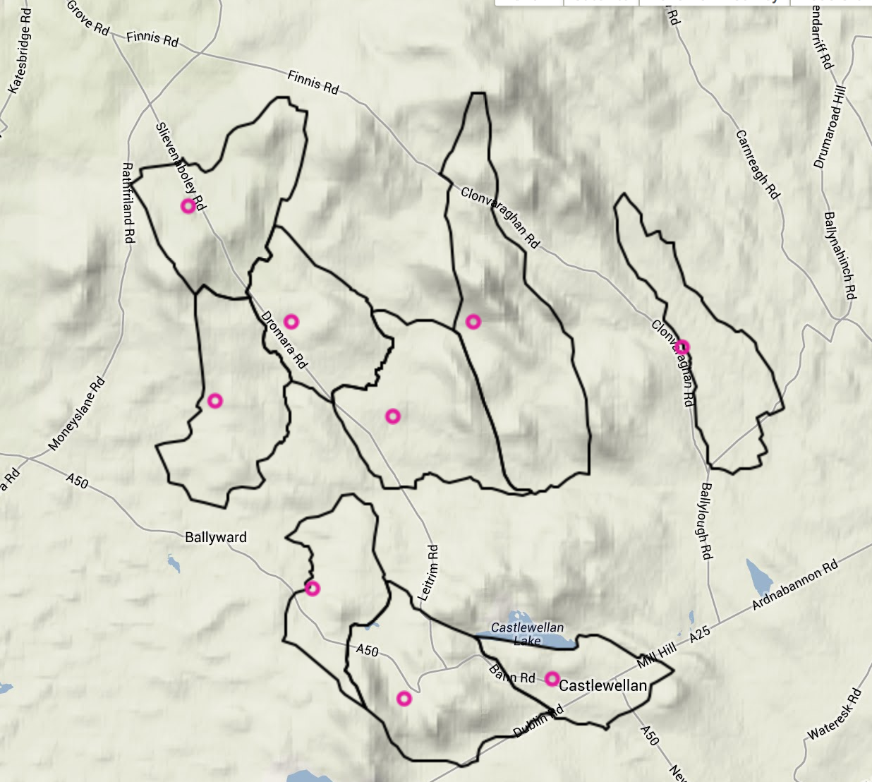
Ever McGinnis land holdings in 1641
Do you have Irish ancestors? If the answer is "yes" then you will want to visit Irish Lands stolen by Oliver Cromwell

Quoting from the website (Trinity College Dublin)

Taken in the years 1656-1658, the Down Survey of Ireland is the first ever detailed land survey on a national scale anywhere in the world. The survey sought to measure all the land to be forfeited by the Catholic Irish in order to facilitate its redistribution to Merchant Adventurers and English soldiers. Copies of these maps have survived in dozens of libraries and archives throughout Ireland and Britain, as well as in the National Library of France. This Project has brought together for the first time in over 300 years all the surviving maps, digitised them and made them available as a public online resource.
It's a fascinating glimpse into lands your ancestors once lived on. There are two parts to the site - the Down Survey Maps and the Historical GIS

The Down Survey Maps section comprises digital images of all the surviving Down Survey maps at parish, barony and county level. The written descriptions (terrier) of each barony and parish that accompanied the original maps have also been included. The second section, Historical GIS, brings together the maps and related contemporaneous sources – Books of Survey and Distribution, the 1641 Depositions, the 1659 Census – in a Geographical Information System (GIS). 
Clicking on the Historical GIS tab takes you to a searchable database for the following:
You can also view details by zooming in on the area of interest. A pop-up displays the name of the landowner, their religion and who ended up with that section of land. 


November 22, 2013

New Map Feature on Pinterest is Pretty Cool

Pinterest has a new feature - the ability to add maps to your boards and pins.  Basically you create a board - here's mine which I just created this morning. It's called Ancestors' Homes

Then you start adding your pins. I decided to add photos of my ancestors, but I could have added any picture (census record, a building, etc) - and it can come from a website or my own computer.

After you add a pin you add the map by typing in the name of the city or town that you want to pin to your photo. 

When you are done, you will see a larger map (as you see here above on the right) which shows all your pins. The pins are on my map are numbered so you can match them to the pictures you put on your board.

This seems to have many genealogical aspects as you could create boards that show immigration patterns or your ancestors' burial spots or birth locations and so on. 

I've only got 3 pins so far on my one map board but wanted to share this new feature with you before heading back to Pinterest to add more. If you want to follow my boards on Pinterest, just go to my boards at Lorine MS